 |
 |
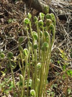 |
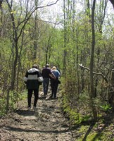
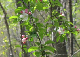
The
Friends of Salem Woods
also
including Forest River Conservation Area
|
The
Friends of Salem Woods |
||||||
The following are available for download. We also try to keep a stock of the brochures at the trail head sign. If you take one there, please return it, they cost money!
Map of Salem Woods (high quality 8x10, 500K)
Trail Guide (describes trails and numbered markers, 100K)
From the south:
From Route 1 north, take Route 60 south to Albert Brown Circle where
you will pick up 107 north.
OR
From Route 1A north, take Route 60 north Albert Brown Circle where
you will pick up 107 north.
Route 107 is Western Avenue in Lynn. Once you enter Salem, Willson Street will be a right at the 5th light. This is approximately two miles. Between the 3rd and 4th lights you will pass McDonalds, Taco Bell and Burger King. Between the 4th and 5th lights there is a car dealership and some new construction.
From Highland Avenue (Route 107) turn right onto Willson Street. Proceed 0.25 mile past Salem High School and the Nathaniel Bowditch School to Olde Salem Green Municipal Golf Course on the right. The trail begins at the far end of the parking lot.
From the north:
From Route 1A, after crossing the bridge into Salem, remain on Bridge Street past the train station, pass under North Street and take the ramp onto North Street. Continue straight. At the second light you will see a Dunkin' Donuts on your right and a Walgreens across the street ahead of you. This is Boston Street. Turn left. Go the short distance to the next light. You will see a monument in the middle of the street, turn right.
At the third light after this (you will pass Collins Middle School and North Shore Medical Center) turn left onto Willson Street. Proceed 0.25 mile past Salem High School and the Nathaniel Bowditch School to Olde Salem Green Municipal Golf Course on the right. The trail begins at the far end of the parking lot.
From Route 128, take the Lowell Street exit and follow this all the way through Peabody and into Salem. Continue straight. When you can no longer go straight, you will see a monument in the middle of the street, turn right.
At the third light after this (you will pass Collins Middle School and North Shore Medical Center) turn left onto Willson Street. Proceed 0.25 mile past Salem High School and the Nathaniel Bowditch School to Olde Salem Green Municipal Golf Course on the right. The trail begins at the far end of the parking lot.
NOTE: The end of the parking lot where the trail begins usually has space available as it is away from the clubhouse. If the golf course is closed, or you are concerned that you may not be out of the woods before the parking lot gates are closed (half hour after sundown), then park at the High School. Facing the High School, you will see a fenced in athletic field on a hill to the left. A short path runs in front of the fence which connects to the golf course parking lot right at the beginning of the nature trail.
Public Transportation:
MBTA bus #450 stops at the corner of Highland Ave. and Willson St. (Salem High School). You can find the bus schedule on-line at
|
Home | Map | Photo Galleries | Documents/Lists | About Us/Contacts ©2003 Friends of Salem Woods - Web site
maintained and donated by Richard Frenkel
|